Plan the Best 7-Day RV Trip: Arizona to Utah Route
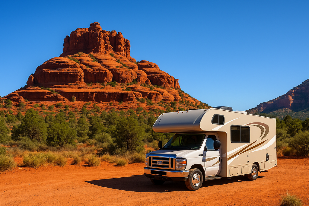
Sedona red rocks near Bell Rock
Day 1: Phoenix to Sedona, AZ
Distance: ~115 miles | Drive Time: 2–2.5 hours
Route Summary
From the desert heat of Phoenix to the red rock beauty of Sedona, this first leg of your journey kicks things off with scenic views and easy highway driving. You’ll take I-17 North nearly the whole way before turning onto the famous Red Rock Scenic Byway (AZ-179).
Turn-by-Turn Directions
- Depart Phoenix via Loop 101 or Loop 202, then merge onto I-17 North
- Continue on I-17 N for approximately 95 miles toward Camp Verde
- Take Exit 298 for AZ-179 North toward Sedona/Village of Oak Creek
- Drive 14 miles north on AZ-179 through the Village of Oak Creek to Sedona
Note: The route climbs from 1,000 ft in Phoenix to 4,350 ft in Sedona. Use tow/haul mode and monitor engine temperature on warm days.
Fuel & Supply Stops
- Black Canyon City (Exit 242): Last convenient, RV-friendly gas station before elevation gain
- Fry’s – Camp Verde (Exit 287): Full grocery stop with propane, restrooms, and RV parking
Optional Scenic Detours
- Montezuma Castle National Monument (Exit 289): Short walk to ancient cliff dwellings
- Bell Rock Vista (AZ-179): Iconic red rock formation with nearby trail access
Ideal Travel Window
- Depart Phoenix between 8:00–9:00 AM to avoid traffic and summer heat
- Arrive in Sedona early to secure a campsite and enjoy an afternoon hike or overlook
Where to Camp
Option 1: Manzanita Campground
GPS: 34.9943° N, 111.7397° W
– Shaded creekside camping in Oak Creek Canyon
– No hookups, max RV size ~24 ft
– First-come, first-served
Option 2: Rancho Sedona RV Park
GPS: 34.8672° N, 111.7633° W
– Full hookups
– Walking distance to Tlaquepaque and downtown Sedona
– Advance reservations strongly recommended
Recommended RV Gear for Day 1
Tip: AZ-179 is known for its scenery and roundabouts. Drive slow, stay alert, and use scenic pullouts for photos instead of stopping on the shoulder.
Tuba City views near Navajo land
Day 2: Sedona to Flagstaff, AZ
Distance: ~30 miles | Drive Time: 45–60 minutes
Route Summary
This short but stunning drive takes you up through Oak Creek Canyon, one of Arizona’s most scenic byways. You’ll leave Sedona via AZ-89A N, winding your way past towering cliffs and shaded forests until you reach the high-elevation city of Flagstaff — a laid-back mountain town surrounded by pines and peaks.
Turn-by-Turn Directions
- Exit Sedona via AZ-89A North (follow signs toward Oak Creek Canyon/Flagstaff)
- Drive approximately 28 miles through Oak Creek Canyon to reach Flagstaff
- Optional: Detour at the top to Oak Creek Vista scenic overlook before heading into town
Note: AZ-89A is steep and curvy with elevation gain. Use low gear and drive cautiously, especially in RVs over 35 feet.
Fuel & Supply Stops
- Safeway – Sedona: Grab groceries, water, or propane before heading out
- Mobil or Speedway – Flagstaff: RV-friendly gas options near downtown
Optional Scenic Stops
- Slide Rock State Park: Natural red rock water slide; fun stop for families
- Oak Creek Vista: Cliff-top viewpoint with Native artisan booths
- Downtown Flagstaff: Historic Route 66 charm, local shops, breweries
Ideal Travel Window
- Depart Sedona by 10:00 AM for a relaxed drive and campsite arrival
- Afternoon arrival leaves time for exploring downtown or a short hike
Where to Camp
Option 1: Fort Tuthill County Park
GPS: 35.1422° N, 111.6881° W
– Partial hookups available
– Wooded sites, peaceful setting
– Great access to hiking and Flagstaff attractions
Option 2: Boondocking – Walnut Canyon Dispersed Area
GPS: 35.1794° N, 111.5067° W
– Free dispersed camping east of Flagstaff
– No services (pack in/pack out)
– Strong cell signal (Verizon + AT&T)
Recommended RV Gear for Day 2
- Non-slip entry mat
- Women’s hiking sandals
- Men’s hiking shoes
- Portable camping fan
- RV clothesline with clips
Tip: If you’re towing, check your brakes and take your time on the climb. Use the Oak Creek Vista as a rest stop before descending into Flagstaff.

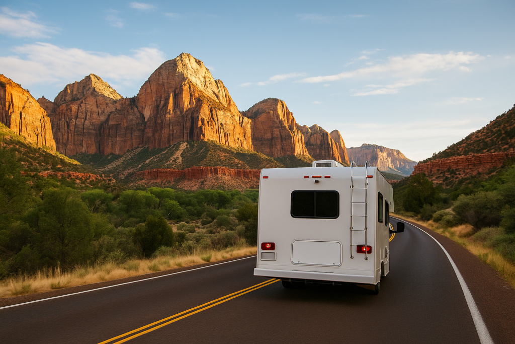
Zion canyon drive near South Entrance
Day 3: Flagstaff to Grand Canyon South Rim
Distance: ~80 miles | Drive Time: 1.5–2 hours
Route Summary
This leg brings you from the cool forests of Flagstaff into one of the most iconic landscapes in the world — Grand Canyon National Park. You’ll climb gradually on US-180 N and AZ-64, arriving at the South Rim where unforgettable views and scenic hiking opportunities await.
Turn-by-Turn Directions
- From Flagstaff, take US-180 N toward Valle
- At Valle, turn right onto AZ-64 N
- Continue on AZ-64 N to the South Entrance of Grand Canyon National Park
- Follow signs to your campground or viewpoint
Note: AZ-64 is RV-friendly and regularly traveled. Expect occasional slowdowns due to traffic near the park entrance. Cell service is limited once inside the park.
Fuel & Supply Stops
- Flagstaff (before leaving): Top off fuel and water; there are few options between Flagstaff and the park
- Valle, AZ: Has a gas station and small general store, but prices are higher
Optional Scenic Stops
- Arizona Snowbowl Scenic Drive: Optional detour before leaving Flagstaff for high-elevation views
- Tusayan, AZ: Gateway town just outside the South Entrance — grab last-minute groceries or lunch
- Mather Point: A quick stop near the visitor center that gives a dramatic first view of the canyon
Ideal Travel Window
- Leave Flagstaff in the morning (around 9–10 AM) to reach the park before peak crowds
- Midday is great for first views or ranger programs; late afternoon offers soft light for photos
Where to Camp
Option 1: Mather Campground
GPS: 36.0495° N, 112.1218° W
– National Park Service campground within the South Rim area
– No hookups, but clean restrooms and dump station
– Book well in advance (recreation.gov)
Option 2: Boondocking – Forest Road 302 Dispersed
GPS: 35.9903° N, 112.1239° W
– Free dispersed camping outside the park boundary
– No services
– Popular with vanlifers and dry campers
Recommended RV Gear for Day 3
- Compact binoculars
- Wide-brim sun protection hat
- Lightweight refillable water bottle
- Hydration backpack
- LED headlamp
- Outdoor/camping blanket
Tip: Grand Canyon nights can get cold, even in summer. Bring layers, and don’t forget to fill your water jugs before entering the park — water fill stations are not always nearby in the campgrounds.
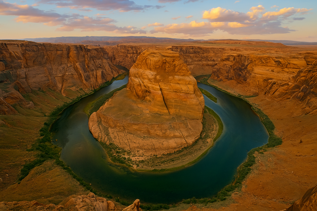
Iconic view of Horseshoe Bend near Page, AZ
Day 4: Grand Canyon to Page, AZ (Horseshoe Bend + Lake Powell)
Distance: ~130 miles | Drive Time: 2.5–3 hours
Route Summary
After sunrise at the canyon, you’ll head northeast on AZ-64 toward US-89, passing through desert plateaus and small towns before reaching Page. This small but bustling adventure hub offers jaw-dropping stops like Horseshoe Bend, Antelope Canyon, and the shores of Lake Powell — making it one of the most photogenic legs of the trip.
Turn-by-Turn Directions
- Exit Grand Canyon South Rim via Desert View Drive (AZ-64 East)
- Stop at Desert View Watchtower for panoramic canyon views
- Merge onto US-89 North toward Page
- Follow signs into Page, AZ — continue to Horseshoe Bend or your chosen campground
Note: Cell service may drop on parts of US-89. Fill up on gas before leaving the park.
Fuel & Supply Stops
- Desert View Market: Small store with snacks and water on the way out of the park
- Page, AZ: Full grocery stores, gas stations, laundromats, and outfitters
Optional Scenic Stops
- Desert View Watchtower: Historic viewpoint and tower near the East Rim
- Little Colorado River Gorge: Free roadside pull-off with deep canyon views
- Glen Canyon Dam Overlook: Just before entering Page — great photo op
Ideal Travel Window
- Leave Grand Canyon by 9:00 AM for sightseeing along the drive
- Arrive in Page by mid-afternoon to visit Horseshoe Bend or relax by Lake Powell
Where to Camp
Option 1: Wahweap RV & Campground (Lake Powell)
GPS: 36.9985° N, 111.4937° W
– Full hookups, showers, dump station
– Walkable to Lake Powell beaches and marina
– Book early during peak season
Option 2: Lone Rock Beach Primitive Camping
GPS: 37.0165° N, 111.5466° W
– $14/night, directly on the sand
– No hookups; vault toilets available
– Large RVs welcome; 4WD recommended for deep sand areas
Recommended RV Gear for Day 4
Tip: Horseshoe Bend has minimal shade. Wear a hat, bring water, and avoid mid-afternoon heat if possible. Arrive early or at sunset for the best light and fewer crowds.
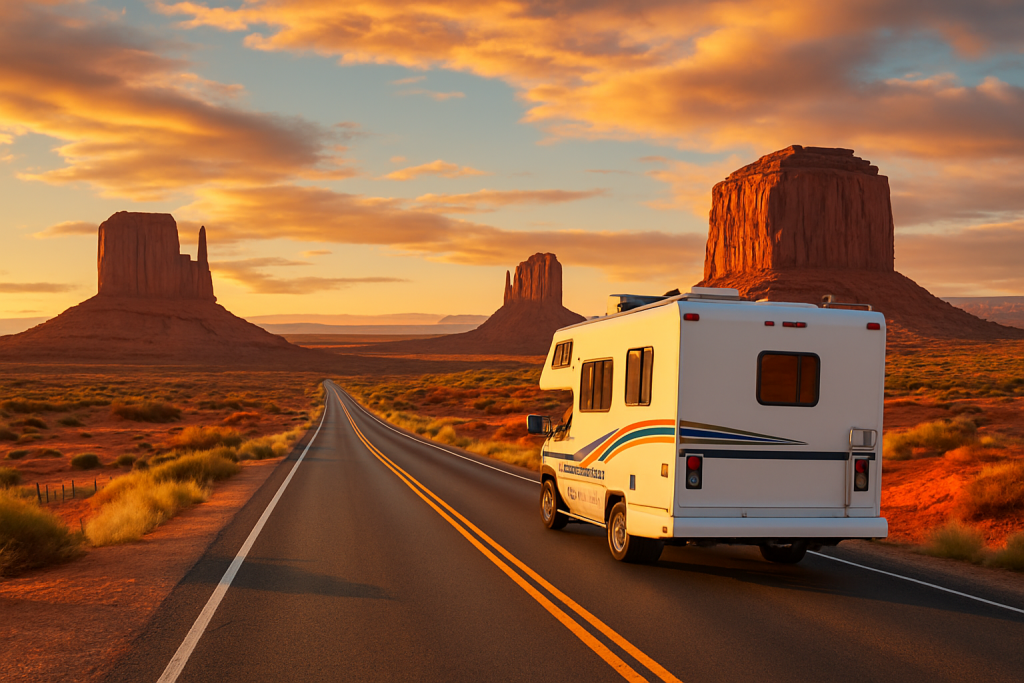
RV traveling through Monument Valley on scenic US-163
Day 5: Page, AZ to Monument Valley (Through Navajo Nation)
Distance: ~125 miles | Drive Time: 2.5–3 hours
Route Summary
Prepare for one of the most iconic drives in the Southwest. Leaving Page, you’ll pass through the heart of Navajo Nation, with stunning desert views and red rock mesas lining the road. Monument Valley offers one of the most unforgettable landscapes in the U.S., especially at sunrise and sunset. It’s a slower-paced day — perfect for reflection, photos, and cultural appreciation.
Turn-by-Turn Directions
- From Page, take US-89 South
- Turn east on US-160 toward Kayenta
- At Kayenta, turn north onto US-163
- Continue on US-163 to Monument Valley Navajo Tribal Park
Note: This route passes through sovereign tribal land. Be respectful of local signage and speed limits. Some areas have limited cell signal.
Fuel & Supply Stops
- Page, AZ: Last full-service town until Monument Valley
- Kayenta, AZ: Gas stations, small grocery store, fast food options
Optional Scenic Stops
- Agathla Peak: Towering volcanic plug near Kayenta — can be seen from the road
- Forrest Gump Point: Famous photo spot on US-163 with perfect road-to-mesa shot
- Monument Valley Scenic Drive: Requires park entrance fee; some roads are rough and not RV-friendly — consider a guided tour
Ideal Travel Window
- Leave Page by late morning to allow for scenic stops and fuel in Kayenta
- Arrive in Monument Valley by 3–4 PM to catch golden hour and enjoy the view from your campsite
Where to Camp
Option 1: The View Campground (Inside Tribal Park)
GPS: 36.9824° N, 110.1124° W
– Full hookups available
– Best sunrise and sunset views
– Advance booking required; fills quickly
Option 2: Goulding’s RV & Campground
GPS: 37.0072° N, 110.2141° W
– Full-service RV park with showers, laundry, and store
– Shuttle to Tribal Park and tours available
Recommended RV Gear for Day 5
- RV leveling blocks
- Compact tripod
- Travel journal or adventure log
- Refillable propane canister
- Small dust broom
Tip: Monument Valley campsites may have uneven terrain. Use leveling blocks, and be prepared for light dust and sand. Keep your camera or phone ready — the views change by the hour.
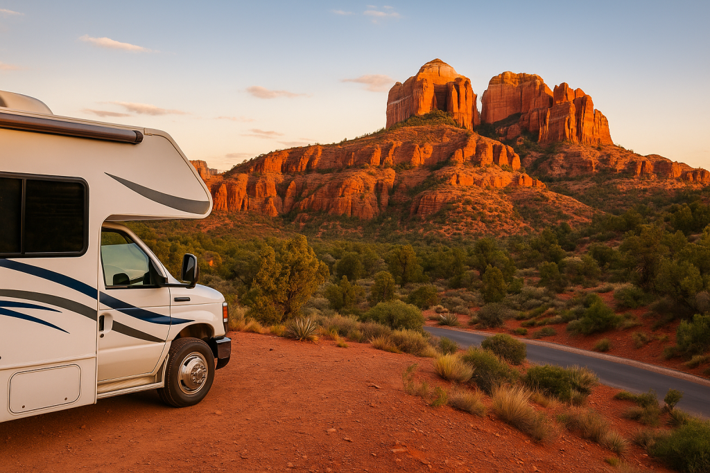
RV descending into Oak Creek Canyon near Sedona, AZ
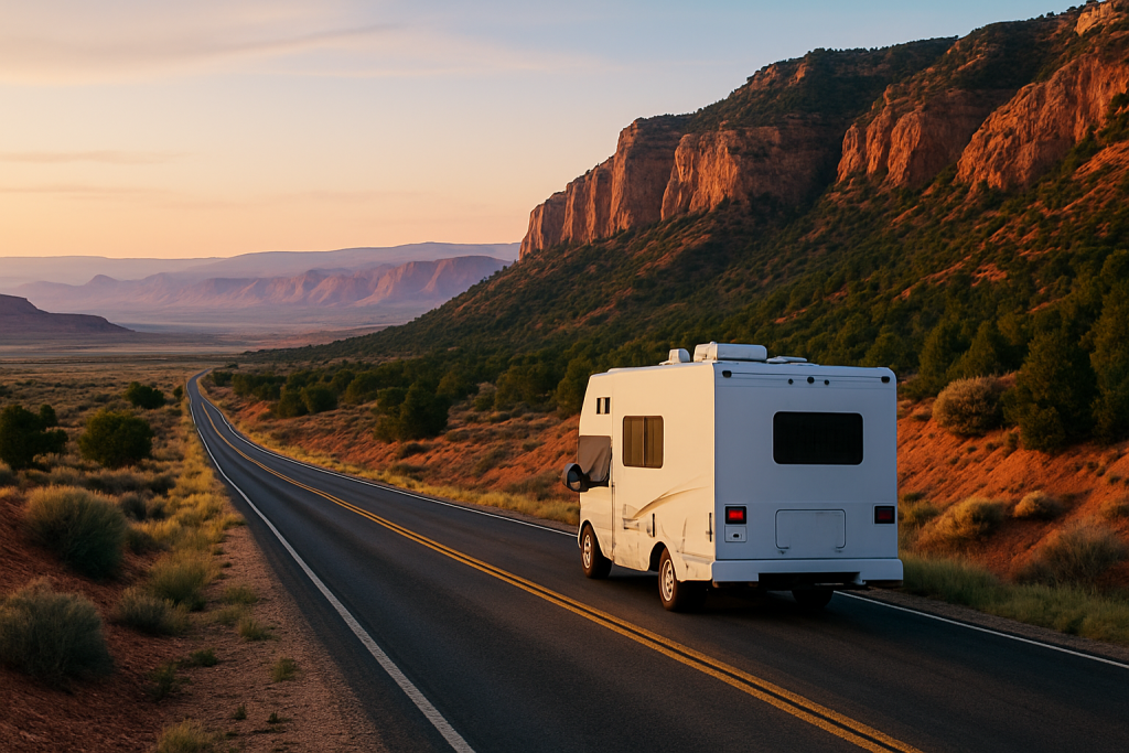
Day 6: Monument Valley to Sedona, AZ (Through Painted Desert & Oak Creek Canyon)
Distance: ~200 miles | Drive Time: 4.5–5.5 hours
Route Summary
Today’s drive is one of transition — from the iconic sandstone spires of Monument Valley to the vibrant red rocks and lush canyons of Sedona. You’ll pass through portions of the Painted Desert, Navajo Nation, and high desert plateaus before descending into the tree-lined switchbacks of Oak Creek Canyon. Plan for a longer drive, but the destination is well worth it.
Turn-by-Turn Directions
- From Monument Valley, head south on US-163 to Kayenta
- Take US-160 West through Tuba City
- Turn onto AZ-89 South toward Flagstaff
- Merge onto AZ-89A South through Oak Creek Canyon into Sedona
Note: AZ-89A is narrow and winding — drive cautiously and allow time for scenic pullouts.
Fuel & Supply Stops
- Kayenta, AZ: Quick fill-up before heading west
- Tuba City: Grocery store, gas stations, fast food
- Flagstaff, AZ: Full-service town with all major chains and RV services
Optional Scenic Stops
- Painted Desert Vista: Brightly colored desert landscapes near Tuba City
- Cameron Trading Post: Great Navajo jewelry, art, and local souvenirs
- Oak Creek Canyon Overlook: Stunning viewpoint just before descending into Sedona
Ideal Travel Window
- Depart Monument Valley by 9:00 AM
- Allow time for lunch or shopping at Cameron or Flagstaff
- Plan to arrive in Sedona before sunset for your first red rock views
Where to Camp
Option 1: Rancho Sedona RV Park
GPS: 34.8676° N, 111.7551° W
– Full hookups, showers, laundry
– Walkable to Tlaquepaque arts village and Oak Creek
– Shaded, quiet sites (book ahead)
Option 2: Coconino National Forest Dispersed Camping
GPS: Varies by road segment; check USFS map
– Free dispersed camping south of town
– No amenities; pack in/pack out
– Great for solar rigs and quiet boondocking
Recommended RV Gear for Day 6
Tip: If staying near town, try to arrive before dark — Sedona traffic and signage can be tricky to navigate at night. Cell service is strong in most areas, but National Forest roads may vary.
Golden-hour drive through red rock country outside Sedona, AZ
Day 7: Sedona to Phoenix, AZ (Loop Finale & Travel Day)
Distance: ~120 miles | Drive Time: 2–2.5 hours
Route Summary
The final stretch of your Southwest RV adventure offers a relaxing drive south through Cottonwood, Camp Verde, and into the Phoenix metro area. Whether you’re heading home, parking your rig, or continuing your journey, this is a great day to wind down, reflect, and prep for what’s next. You’ll drop from the cool red rocks of Sedona into the desert heat of central Arizona — so keep your rig and passengers cool and comfortable along the way.
Turn-by-Turn Directions
- From Sedona, take AZ-179 South toward I-17
- Merge onto I-17 South toward Phoenix
- Continue into the Phoenix area; exit based on your next destination
Fuel & Supply Stops
- Camp Verde: Quick stop for gas, snacks, and a stretch
- Black Canyon City: Last scenic overlook before city traffic
- Phoenix Metro: Plenty of grocery, propane, RV supplies and repair options
Optional Scenic Stops
- Montezuma Castle National Monument: Just off I-17 near Camp Verde
- Sunset Point Rest Area: Stunning overlook with bathrooms and picnic areas
Ideal Travel Window
- Leave Sedona by mid-morning to beat Phoenix afternoon traffic
- If returning a rental RV, allow time for fuel and cleaning before drop-off
- Expect increased temps as you descend — keep passengers hydrated
Where to Camp or Wrap Up
Option 1: Covered Wagon RV Park (Phoenix)
GPS: 33.5873° N, 112.1149° W
– Full hookups, pool, Wi-Fi
– Great for resting before your next leg or drop-off
Option 2: Lost Dutchman State Park (Apache Junction)
GPS: 33.4455° N, 111.4792° W
– Stunning views of Superstition Mountains
– Dry camping and electric sites available
– Ideal for a peaceful final night before leaving the region
Recommended RV Gear for Day 7
Tip: Don’t rush the last day. Clean your rig, organize your gear, and jot down your favorite memories while they’re fresh. You’ve just completed one of the most scenic loops in the Southwest!
Final Thoughts: Ready to Hit the Road?
Whether you’re a full-time RVer or weekend explorer, this 7-day loop through Arizona and Utah blends jaw-dropping views with practical drive times and unforgettable campsites. With the right gear, a flexible spirit, and a few backup plans, this route can be a stress-free adventure you’ll talk about for years.
Every stop was chosen with RVers in mind — from dispersed boondocking options to full-hookup parks near natural wonders. The gear lists are real tools I’ve used or researched to make the journey smoother, cooler, and a little more comfortable when the desert heat kicks in.